River deltas are shaped by the movement of freshwater, sediment, tides, and nutrients. Estuaries and connected wetlands can provide feeding or nursery habitat for fish and invertebrates, but the mix varies with salinity, sediment, season, and human structures. The phrase 'nursery' should be tied to particular species and places rather than treated as a universal role for every delta.
Dams, channel engineering, pollution, land conversion, and sea-level change can alter these processes. Effective monitoring pairs water and sediment measurements with surveys of the organisms using each habitat. NOAA's estuary material is U.S.-focused, so local river-basin authorities are the right source for species and management detail elsewhere.
The delta is where a river spreads its influence
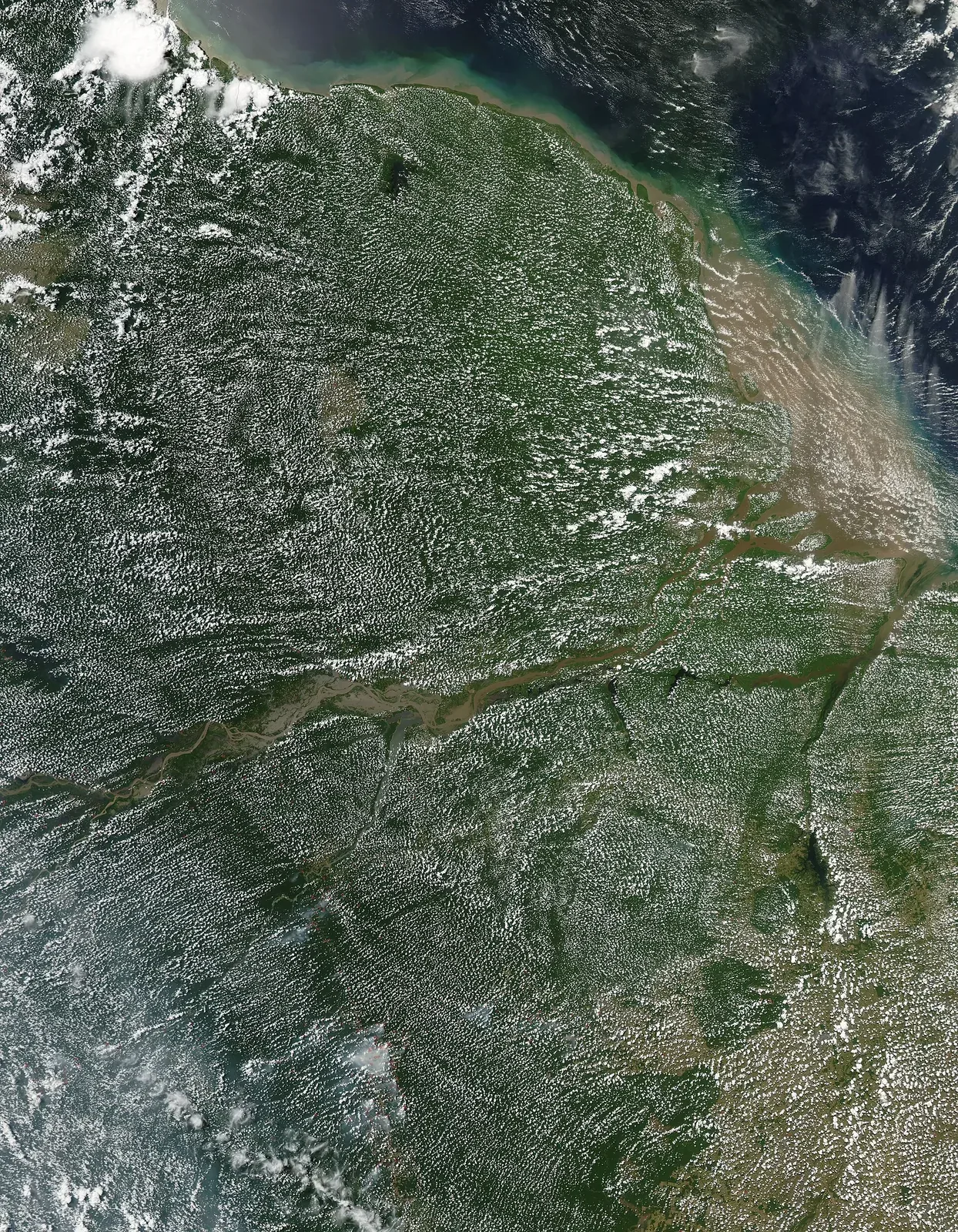
A river delta forms where a river slows as it meets a larger body of water and deposits sediment across branching channels. These changing landforms include distributaries, mudflats, marshes, lagoons, and other habitats. The exact shape depends on river flow, sediment supply, waves, tides, and human modifications. For fish, the delta is not merely a boundary between land and sea: it can provide feeding, nursery, and migration habitat. A useful article identifies the particular delta or fish group under discussion, because ecological roles and pressures differ among river systems around the world.
Nursery habitat is a life-stage idea
The term nursery describes areas where juvenile fish find conditions that support survival and growth before moving into other habitats. Shallow water, vegetation, prey, and reduced exposure to some predators can make certain estuarine and delta areas important during early life stages. Not every species uses every delta in the same way, and not every fish caught offshore developed there. NOAA's estuary guidance describes how fresh and salt water mix and how habitat types such as marsh, seagrass, and mangrove support different organisms. Specific fishery claims should be backed by species-level studies or agency data for the region.
Sediment builds habitat and can also bury it
Sediment is part of a delta's natural construction, but changes in how much arrives and where it settles can alter channels and habitat. Dams upstream may trap sediment; land clearing can increase erosion; dredging and embankments can redirect flows. Excess sediment in a sensitive estuary may smother vegetation or reduce water clarity, while too little can prevent wetlands from keeping pace with changing water levels. These outcomes depend on grain size, flow, and local geomorphology. Monitoring should distinguish natural sediment movement from human-caused change and avoid treating any single sediment level as ideal for every species.
Freshwater flow affects salinity and access
The amount and timing of river flow influence how far salt water moves inland and how long low-salinity conditions persist. Fish and invertebrates respond to these gradients, and some species move as conditions change. A fixed salinity sample is only a snapshot; seasonal records and river discharge data can reveal whether a habitat is changing. Water withdrawal, dams, and altered flood timing can all affect the system. Local management needs to consider both the delta and the upstream basin, because decisions far from the coast can change the water and sediment that reach the estuary.
Barriers reshape migration routes
Dikes, levees, tide gates, and road crossings can protect infrastructure while changing access to habitat. A barrier may prevent fish from reaching a spawning area or alter the flooding that sustains a wetland. Restoration can include opening tidal exchange, modifying a culvert, or reconnecting a side channel, but the design must reflect local species and flood risks. Before-and-after monitoring should measure fish passage, salinity, vegetation, and water levels. NOAA's estuary restoration resources emphasize the need to document outcomes; a project is not successful simply because a barrier has been removed.
Deltas are also working landscapes
People live, farm, fish, transport goods, and build communities in deltas. Conservation decisions therefore involve trade-offs among habitat, food, flood protection, and livelihoods. Local knowledge can identify which channels remain usable and when fish move, while scientific surveys offer repeatable measures. Participation should happen before a project is fixed, not only after a design is complete. A fair report explains who benefits from restoration and who may bear costs. It avoids treating communities as background scenery in a wildlife story or suggesting that conservation can proceed without attention to land rights and local economies.
How to evaluate a delta conservation claim
Ask what was measured: fish abundance, species richness, juvenile survival, habitat area, or water quality. Ask where and when, and whether the method was repeated. NOAA Fisheries identifies estuaries as important habitat for many fish, but a national statistic cannot establish the contribution of an individual delta. A strong local account links its claim to the study area and fish species, then notes other influences such as fishing pressure or upstream flow. Deltas shift naturally, so conservation is not about freezing a coastline in place. It is about retaining the processes that let habitat and communities adapt.
Deltas are not only fish habitat: they also support transport, agriculture, settlements, and cultural livelihoods. Conservation measures can therefore create trade-offs around water allocation, flood protection, and sediment. Public engagement and transparent monitoring help clarify who benefits and who bears the costs of a proposed intervention.