Snow leopards occupy high mountain landscapes across Central and South Asia, where cliffs, ridgelines, and prey movements matter more than administrative borders. A camera-trap image can confirm presence at a location, but a cluster of detections alone cannot establish a population increase: survey design, effort, and repeated sampling affect what the photographs can tell us.
Conservation therefore combines prey and habitat protection with measures that lower conflict around livestock and reduce fragmentation from roads or infrastructure. Population estimates should be reported with the assessment date and method because published estimates differ. This overview avoids claiming that sightings along one range prove a regional recovery; that conclusion requires comparable monitoring across years.
A mountain range is not a single survey site
Snow leopards occupy a vast, rugged range across Central and South Asia. A camera image from one valley confirms that an animal passed that camera; it cannot, by itself, establish that the species is increasing across the Altai or across its full range. Snow Leopard Network and GSLEP guidance stresses survey design at meaningful spatial scales because individuals move over large areas and detection is uneven. The first question is therefore not how many pictures appeared, but what area was sampled, for how long, and whether animals could be detected more than once.
Why rosettes make identification possible
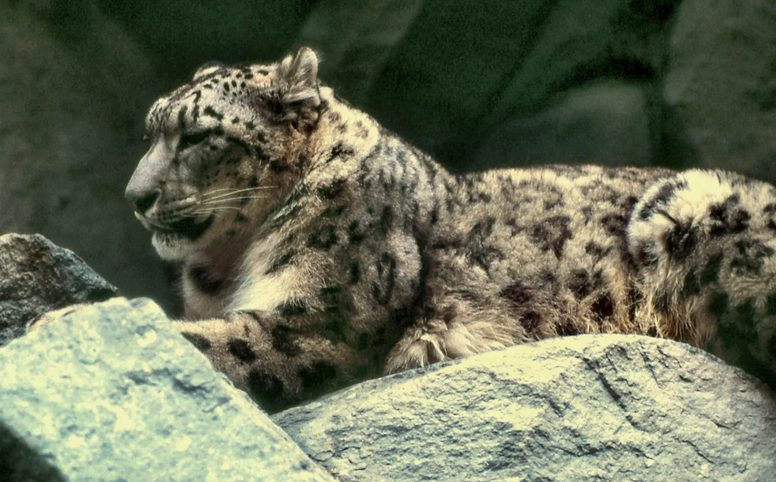
The dark rosettes on a snow leopard's coat can help researchers distinguish individuals in photographs, much as a fingerprint pattern can help separate one animal from another. But identification is not automatic. Images may be blurred, partly obscured, or taken from angles that hide the markings needed for a confident match. Training and evaluation tools can estimate how reliable a human identification is; that uncertainty should travel into the analysis instead of disappearing when a spreadsheet is assembled. A careful study reports ambiguous matches and the rules used to accept or reject them.
From photographs to density estimates
A rigorous camera-trap study uses a planned network of cameras and a defined sampling period. Researchers place paired units or choose sites where both flanks can be photographed, maintain them consistently, and record the effort and downtime. Spatial capture–recapture methods use repeated detections at known locations to estimate how animals use the sampled area. The method depends on assumptions about movement and detection, so a small set of opportunistic images is not equivalent to a designed survey. The resulting estimate should include uncertainty and a clear description of its geographic boundary.
The Altai context: prey and people
In the Altai, snow leopard habitat is connected to the condition of mountain grasslands, cliffs, and prey populations such as wild sheep and goats. Livestock herding is also part of the same landscape. When wild prey is scarce or herds are poorly protected, conflict can intensify, but the relationship varies across communities and seasons. It is misleading to frame pastoralists as a uniform threat or to assume that every livestock loss leads to retaliation. Local interviews, verified incident records, and ecological surveys can show where prevention tools are relevant and where other pressures deserve attention.
A count is not the only useful result
Monitoring can answer several questions besides abundance. Camera records may reveal distribution, activity periods, use of ridgelines, or whether a corridor is being crossed. Genetic samples can help identify individuals and connect populations, while ungulate surveys provide information about the prey base. These methods have different costs and limitations; combining them can make a picture more complete, but only when sampling locations and time periods are comparable. A report that explains what it could not measure is often more valuable than one that presents a precise-looking number without describing the uncertainty behind it.
Conservation works at multiple scales
Protected areas can provide important habitat, yet many are smaller than a snow leopard's movements require or are surrounded by roads, mines, grazing land, and settlements. Community-led livestock insurance, predator-proof night enclosures, and carefully evaluated compensation programmes are among the approaches used in parts of the range. Each intervention should be assessed locally: a measure that reduces losses in one setting may be too costly or unsuitable elsewhere. Cross-border cooperation also matters because mountain wildlife does not stop at administrative boundaries, and consistent monitoring can reveal whether separate valleys function as connected habitat.
What a rising sighting count can and cannot say
More detections may reflect more animals, but they can also result from additional cameras, better placement, longer sampling, or improved image classification. A trend claim needs repeated surveys with a comparable design, or a statistical model that explicitly accounts for changing effort. This distinction is especially important for an elusive species in remote terrain, where a handful of new records can attract attention. The strongest account of snow leopard monitoring pairs photographs with methods, dates, and limits, then links any population interpretation to a published assessment rather than treating a striking image as a census.
Camera-trap studies are most informative when they report where cameras were placed, how long they operated, and how detection probability was handled. Without that detail, a rise in photographs may reflect increased effort or changed placement rather than more cats. Similar caution applies when comparing one valley with another.